Please be aware that the northern half of Vermont was affected by major flooding. Roads to trailheads may not be open for the weekend, turn around if you encounter closed roads.

Fletchers Cascade

A hike to a cascade on the lower shoulder of the trail-less Flat Mountain.
Trail Activity
Hiking Snowshoeing
Length
3.20 miles, Round Trip
Difficulty
Easy
Town
Waterville Valley (NH)
Surface
Packed Earth/Dirt, Rock/Ledge
Pets
Permitted
Fees
No

Description

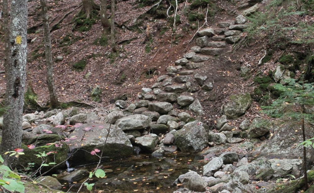
From the Sandwich Mountain/Drake's Brook parking lot, head left and quickly right around the gate. Follow the Drakes Brook XC Ski Trail for 0.4 mile. Shortly after the Drakes Brook hiking trail diverges right, turn right onto the Fletchers Cascade Trail. The trail climbs gently along Bowlder Brook into the Sandwich Range Wilderness. After crossing the brook, the trail heads up a few rock steps and culminates at the chutes and ledges of Fletchers Cascade. 

It is not advisable to venture across or above the cascade, due to poor footing on slippery, steep rocks.

Other Information

Before you hike, know the hiker responsibility code and be prepared:

  • With knowledge and gear
  • To leave your plans
  • To stay together
  • To turn back
  • For emergencies
  • To share the hiker code with others.

 Visit the hikeSafe website to learn more!

Trail Manager

For more information, visit the White Mountain National Forest hiking page, or the Waterville Valley Athletic & Improvement Association website, or contact:

Waterville Valley Athletic & Improvement Association

Waterville Valley Athletic & Improvement Association
PO Box 412
Waterville Valley, NH 03215
wvaiatrails@gmail.com
View website

White Mountain National Forest: Pemigewasset Ranger District

White Mountain National Forest: Pemigewasset Ranger District
71 White Mountain Drive
Campton, NH 03223
Phone: (603) 536-6100
View website

Trail Tips

Dispose of Waste Properly
Pack it in, pack it out. This goes for trash, leftover food, toilet paper, and hygiene products. If you brought it into nature, please bring it out.
Legend
Hide All

Trailhead Information

The Sandwich Mountain/Drakes Brook Parking lot is on the east side of the road 10.0 miles north of Exit 28 on I-93 and one mile south of Waterville Valley on NH-49. If you reach Tripoli Road going north, you've gone one mile too far.

Click on a parking icon to get custom directions
Please Log In or Create Account to add comments.
These awesome businesses support our goal of connecting people to outdoor adventures!
Hang Tight!
Nearby services are loading
No Results
No Services Found
SHARE THIS TRAIL

Add Trail Log

Please wait…
Join In on the Fun!
Log in or create an account below to unlock all the great features of Trail Finder: keep track of trails you want to do, preserve memories of trails you’ve done, earn badges, and more!
Your log in attempt was not successful. Please try again.
    Lost your password? Reset your password
    Don't yet have an account?
    There was an issue with your submission. Please try again.
      * Indicates required field
      Already have an account? Login here
      Enter your username, and we will send you a new, randomly generated password to your email account.
      There was an issue with your submission. Please try again.

        Success! A new password has been emailed to you.

        Log in now

        Please wait…