East Ponds

An easy to moderate hiking trail to remote and scenic ponds from either Tripoli Road or the Kancamagus Scenic Byway.
Trail Activity
Hiking Snowshoeing
Length
8.20 miles, Network
Difficulty
Easy, Moderate
Town
Waterville Valley (NH)
Surface
Packed Earth/Dirt
Pets
Permitted
Fees
No

Description

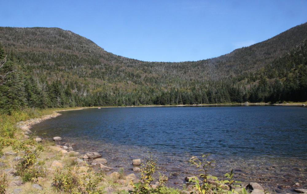
East Pond and Little East Pond are scenic, remote ponds surrounded by mountains. The trails are relatively easy and follow moderate grades. From Tripoli Road, an easy 4.8-mile counter-clockwise lollipop loop follows East Pond Trail to Little East Pond. Then continues on Little East Pond Loop Trail back to East Pond Trail, which returns to the trailhead.

From the Kancamagus Scenic Byway trailhead, the lollipop loop to both ponds is a moderate 11.6 miles. It has some elevation gain and loss over East Pond Pass.

Other Information

Before you hike, know the hiker responsibility code and be prepared:

  • With knowledge and gear
  • To leave your plans
  • To stay together
  • To turn back
  • For emergencies
  • To share the hiker code with others.

 Visit the hikeSafe website to learn more!

Trail Manager

For more information, visit the White Mountain National Forest hiking page, or the Waterville Valley Athletic & Improvement Association website, or contact:

Waterville Valley Athletic & Improvement Association

Waterville Valley Athletic & Improvement Association
PO Box 412
Waterville Valley, NH 03215
wvaiatrails@gmail.com
View website

White Mountain National Forest: Pemigewasset Ranger District

White Mountain National Forest: Pemigewasset Ranger District
71 White Mountain Drive
Campton, NH 03223
Phone: (603) 536-6100
View website

Trail Tips

Travel on Durable Surfaces
If you have to step off the trail, step onto a rock or soil. Avoid stepping on fragile vegetation.
Legend
Hide All

Trailhead Information

East Pond can be accessed from Tripoli Road from the south or from the Kancamagus Scenic Byway from the north.

From Exit 28 on I-93, head north on NH-49 for 10.2 miles, then turn left on Tripoli Road toward Waterville Valley Ski Area. At the "Y", keep right to stay on Tripoli Road (past the W. Branch Road bridge junction) for another 4.6 miles, mostly on gravel, to the trailhead on the right.

From Exit 32 on I-93, head 5 miles east on Tripoli Road then turn left into the trailhead.

Please note that Tripoli Road is closed west of W. Branch Road in the winter.

The northern trailhead is located on the south side of the Kancamagus Scenic Byway (NH-112), 8.8 miles east of Exit 32 on I-93 and 26 miles west of Conway. 

Click on a parking icon to get custom directions
Please Log In or Create Account to add comments.
These awesome businesses support our goal of connecting people to outdoor adventures!
Hang Tight!
Nearby services are loading
No Results
No Services Found
SHARE THIS TRAIL

Add Trail Log

Please wait…
Join In on the Fun!
Log in or create an account below to unlock all the great features of Trail Finder: keep track of trails you want to do, preserve memories of trails you’ve done, earn badges, and more!
Your log in attempt was not successful. Please try again.
    Lost your password? Reset your password
    Don't yet have an account?
    There was an issue with your submission. Please try again.
      * Indicates required field
      Already have an account? Login here
      Enter your username, and we will send you a new, randomly generated password to your email account.
      There was an issue with your submission. Please try again.

        Success! A new password has been emailed to you.

        Log in now

        Please wait…